
Description
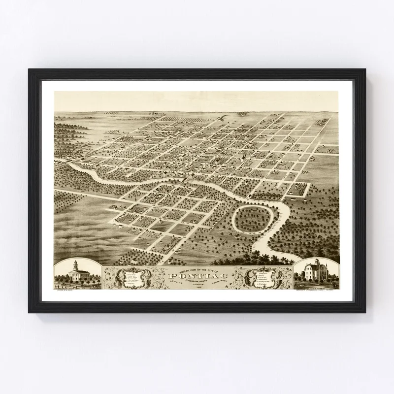
Discover a charming piece of history with our vintage map of Pontiac, nestled in Livingston County, Illinois. Originally crafted in 1869 and now digitally restored, this map offers a glimpse into the past that’ll capture the imagination of any local history enthusiast.
This beautiful print makes for an intriguing addition to any home or office decor. Whether you’re gifting it to a friend or treating yourself, its traditional style easily complements spaces while igniting discussion about Pontiac’s storied past.
Our prints are ready to hang right out of the box – no fuss involved! With solid wood frames that are stained for added richness and polycotton canvas constructed by hand over sturdy wood stretcher bars, their quality is unmistakable. If you prefer an unframed option, you’ll find it printed on high-quality matte paper that’s equally impressive.
Add this delightful map to your collection today and enjoy a unique slice of history that’s sure to enliven any conversation.
Reviews
There are no reviews yet.