
Description
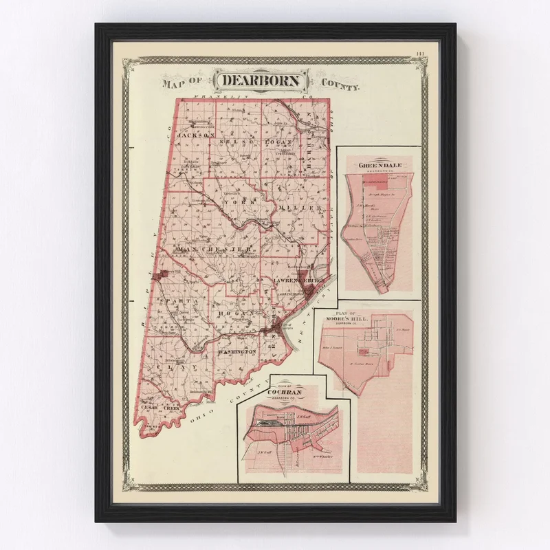
Discover a piece of Indiana’s past with our exquisitely restored 1876 map of Dearborn County. Known for its charming towns like Lawrenceburg, Aurora, and Greendale, this vintage map captures the spirit of local history, making it an ideal gift for history buffs or those who hold a special place in their hearts for the area.
Our maps aren’t just about nostalgia; they’re crafted with precision and care. Each piece is ready to hang straight from the box, offering convenience without compromising on quality. Choose from framed options made with solid wood or unframed prints on beautiful matte paper—each ensuring that every detail is clear and vibrant.
This isn’t just decor; it’s a conversation starter that adds warmth and authenticity to any setting—whether in your living room or at your office. Celebrate Dearborn County’s unique heritage with this handcrafted piece that’s sure to captivate visitors and inspire stories.
Reviews
There are no reviews yet.