
Description
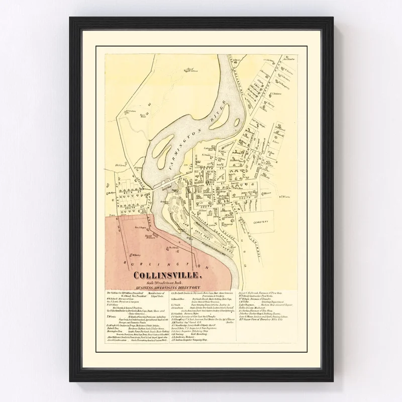
Bring a piece of history into your space with this beautifully restored 1869 vintage map of Collinsville, nestled in Hartford County, Connecticut. This timeless print is perfect for anyone with a love for local history or an eye for traditional decor.
Whether you’re looking to add charm to your home or office, this map doubles as both a conversation starter and a sophisticated accent piece. Each print is crafted with care — frames are made from solid wood stained by hand, ensuring quality that stands the test of time.
If you choose the canvas option, you’ll enjoy prints meticulously made on polycotton canvas stretched across solid wood bars. Prefer it unframed? These versions come printed on high-quality matte paper to suit your liking.
Great as gifts or an addition to your personal collection, these maps arrive ready-to-hang so you can appreciate Collinsville’s past effortlessly right out of the box. Celebrate the rich story of Hartford County without leaving modern elegance behind!
Reviews
There are no reviews yet.