
Description
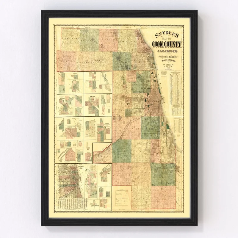
Looking for a piece of local history to add to your home or office? This restored vintage map of Cook County, Illinois, originating from 1886, might just be what you need. Skilled artisans have carefully hand-constructed each piece with top-quality materials, ensuring both durability and style. Whether framed using solid wood, stretched on polycotton canvas over wooden bars, or printed on high quality matte paper for an unframed option—our maps are ready to display right out of the box.
This map doesn’t just showcase the geographical layout; it tells the story of notable places like Chicago and Evanston that have shaped Cook County’s past. With its traditional design aesthetic, it’s perfect as a wall decor option that naturally blends into any environment while sparking intriguing conversations—an ideal gift for history aficionados or geography buffs who appreciate a touch of nostalgia in their space. Experience local heritage in style with our Cook County vintage map print.
Reviews
There are no reviews yet.