
Description
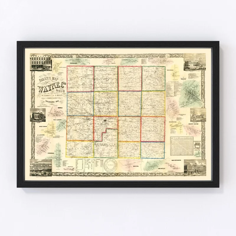
Discover a piece of Ohio’s rich past with our beautifully restored vintage map of Wayne County from 1856. Perfect for history enthusiasts, this map pays homage to the notable towns and communities within the county, like Wooster, Orrville, and Rittman. It’s an intriguing conversation starter that brings a touch of tradition to any space.
Each map is crafted with meticulous attention to quality. The prints are available on high-quality matte paper or durable polycotton canvas and are ready to hang straight out of the box. Our frames are handcrafted from solid wood and stained for a timeless look that’ll complement any home or office decor.
This vintage map print makes a thoughtful gift for anyone who appreciates local history or unique home decor pieces. Whether you’re sprucing up your own living space or giving it as a gift, this map serves as both art and historical reference—a delightful nod to Wayne County’s storied past!
Reviews
There are no reviews yet.