
Description
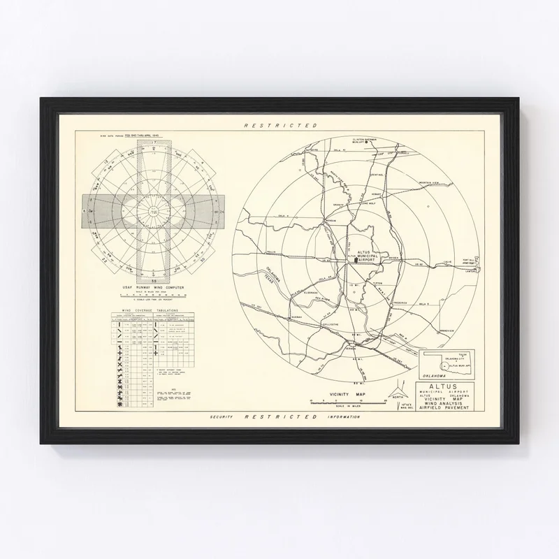
Discover a slice of history with our expertly restored vintage map of Altus, Oklahoma from 1952. Perfect for local history buffs, this map art piece brings Jackson County back to life with remarkable detail and charm. Whether you’re looking to spark conversation or simply appreciate timeless decor, this print is an ideal addition to any home or office.
Each piece stands out due to the quality craftsmanship that our company is committed to providing. The prints are available in different formats tailored to your preference—be it handcrafted canvas on sturdy wood stretcher bars or high-quality matte paper for a classic look. Our framed options feature solid wood with a rich stain that complements any decor style and are ready-for-display as soon as they arrive at your door.
This item isn’t just wall art; it’s a thoughtful gift for anyone who cherishes regional heritage and loves engaging stories from the past. Don’t miss the chance to own this beautiful representation of Altus’s historical landscape!
Reviews
There are no reviews yet.