
Description
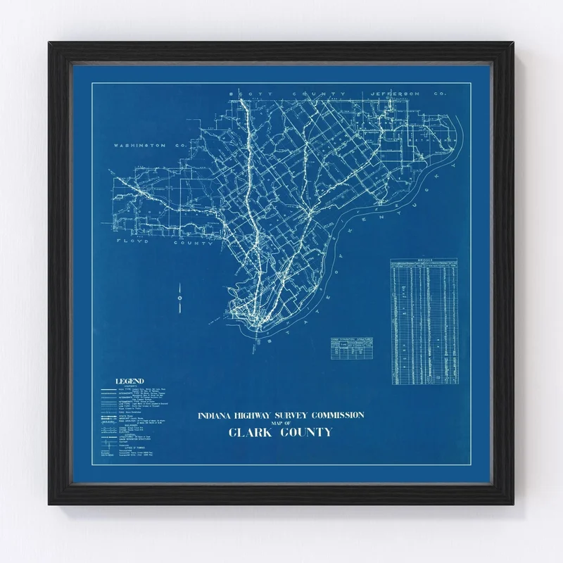
Discover the rich history displayed in this beautifully restored vintage map of Clark County, Indiana from 1936. Perfect for any history buff, this piece serves as both an elegant decor choice and a fun talking point for home or office spaces. Covering notable locales such as Jeffersonville, Charlestown, and Sellersburg, it brings the storied past of these charming towns to life.
Each map is crafted with meticulous care and quality materials, offering ready-to-hang convenience right out of the box. If framed, expect hand-stained solid wood frames that add a touch of warmth to its classic look. For those who prefer canvas prints, we use premium polycotton canvas stretched over solid wood bars by skilled hands. Choose an unframed version? You’ll find it on superb matte paper ideal for framing on your own terms.
This vintage art piece isn’t just a decoration; it’s a tribute to local heritage and a perfect gift idea for enthusiasts of local history.
Reviews
There are no reviews yet.