
Description
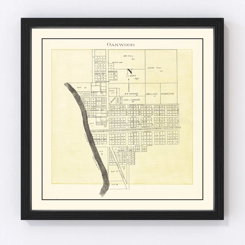
Discover a piece of history with our beautifully restored vintage map of Oakwood, nestled in Paulding County, Ohio. Originally drawn in 1905, this map offers a glimpse into the past and serves as a perfect gift for anyone fascinated by local history or simply looking to add a classic touch to their space.
Whether you’re decorating your home or office, this map is ready for display right out of the box. Each print is crafted meticulously by hand—our framed versions feature solid wood frames that boast an elegant stain finish. The canvas prints are no less impressive; made with high-quality polycotton canvas and supported by solid wood stretcher bars. And if you prefer an unframed look, you’ll appreciate our use of premium matte paper that ensures durability.
This delightful conversation starter not only showcases Oakwood’s historic charm but also reflects top-notch craftsmanship and materials that make it stand out in any setting. Dive into the story behind Oakwood today!
Reviews
There are no reviews yet.