
Description
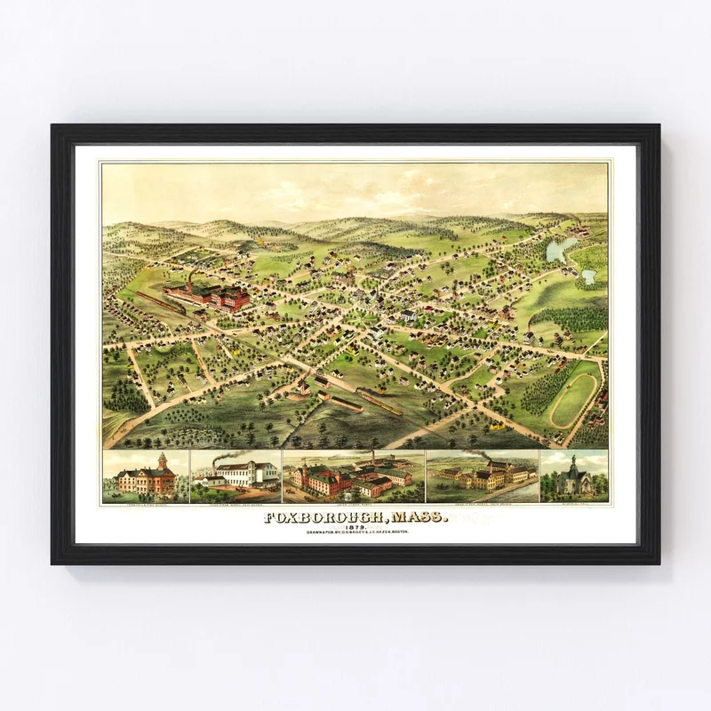
Discover a piece of history with this beautifully restored 1879 vintage map of Foxborough, nestled in Norfolk County, Massachusetts. Perfect for history buffs or anyone with a love for local stories, this map captures the charm and detail of its time. Not only is it perfect for sprucing up your home or office, but it’s also sure to spark interesting conversations about the region’s past.
Our prints are crafted with care and attention to detail. Whether you choose a framed option made from solid wood and tastefully stained or an unframed print on high-quality matte paper, each piece showcases quality craftsmanship. Our canvas prints use polycotton material stretched over solid wood bars to create stunning wall art ready to hang right out of the box.
This unique map makes an ideal gift for those who cherish local heritage or enjoy intriguing decor pieces that combine tradition with class. Bring a bit of Foxborough’s past into your space today.
Reviews
There are no reviews yet.